Open Data and Maps
Last Friday I attended a presentation of Erik Meerbrug. After his Geodesy study at TU Delft he specilised in GIS: geo information systems. In his presentation he mentioned some interesting projects that are happening in the world of geo and open data.
Use of Open Data in GIS
In the Netherlands there are a lot of open data repositories that can be used in in most GIS application. One of the examples he showed was a time lapse video based on the open data of all building in Delft. It showed the year a building was build as dot on the map. You could see how the city of Delft exploded in the number of houses after the second world war. The data set only includes houses that still exists, because they in the past, they only kept track of the houses that still exists and they didn't have an end date in the data set.
Elevated Maps
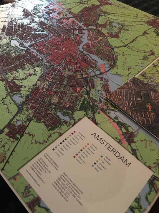
A second project he showed is 3d printed maps based on open data, using inkjet technology patented by Océ Canon, which offers full color relief prints of up to 1m2 and 5mm in height. Together with another company they created the company elevated maps. For the example the map of Amsterdam below, they used Open Street data. (the map is for sale on their website). Other maps use data of General Height Map Netherlands (AHN2), but it can be any open data set.

OpenStreetMaps
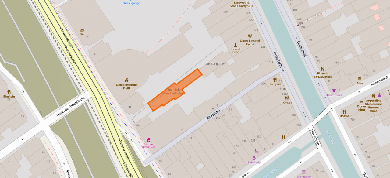
Most of us know Google Maps, but there is also an open alternative that is created the same way as Wikipedia. It is OpenStreetMap. Below is an example of the detail that is included (societeit Standvastigheid is were I had the meeting).

The interesting thing is that when you see something incorrect, you can directly change that. Someone noticed that the Korean restaurant on the corner of the Kloksteeg was still mentioned, so Erik directly changed it. From all objects you can see all the changes, just like the history of a wikipedia article.
Missing Maps
The fourth project he showed is the Missing Maps project. The project is founded by the American Red Cross, British Red Cross, Humanitarian OpenStreetMap Team and Doctors without Borders. The goal of this project is to map the most vulnerable places in the developing world, in order that international and local NGOs and individuals can use the maps and data to better respond to crises affecting the areas. They use satellite images and an invididual or groups will help to draw in all objects and gives items names on OpenStreetMap. One of the things they organise are session to do that in a group. On 18th of February there is an event at the Faculty of Architecture of TU Delft.
No feedback yet
Form is loading...